It was 2:30 in the morning. I was in a strange dark room, disoriented, trying to remember where, exactly, I was. Someone or some THING was moving around in the blacked-out recesses of my vision.
I COULD NOT FEEL MY LEGS.
I tried to wake up from what was a pretty shitty nightmare. Wait…I was already awake. This wasn’t a hideous nightmare. I was in a hotel in Hancock, MD, and I had just slept a blissfully dreamless four and a half hours. I was here because… because… why?… oh right, my Stupid Rides Ride Partner, Brad Greenberg, and I were attempting to complete the Big Savage 600k Super Randonée (that’s k for kilometers, fancy!)
I couldn’t feel my legs because we had finished riding our bikes 190 miles and climbed 21,000 feet just six hours ago and these particular legs were like, fuck you, we are NOT OKAY with you riding more today. Well I am sorry to inform you, MY LEGS, and really the entire lower half of my body, and actually my ENTIRE body, that not only are WE riding today, for some completely sick, twisted reason we are REVERSING the route that we had ridden yesterday and (run-on sentence continues) yes, it would be even harder going this way.
“Hey, I’m up, you want to just get going?”
I think I screamed.
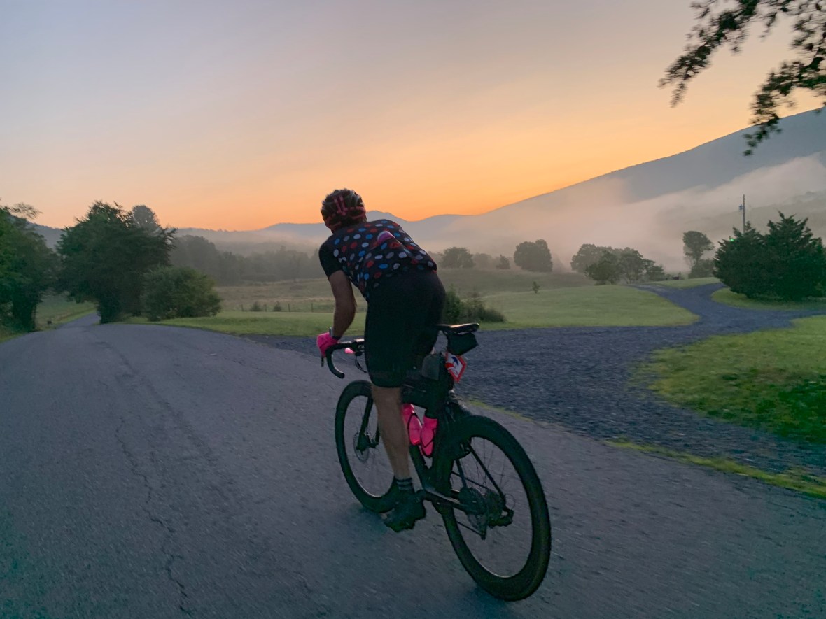
An hour later we rolled out into the vast darkness. Within a few hours, I would be asleep again.
THE RIDE

Big Savage Super Randonée is a 375 mile out and back with over 40,000 feet of climbing (at least 10,000 feet more climbing than Everest) and a 60 hour time limit. You can start at either of the two endpoints (Woodstock, VA or Hancock, MD) and follow an absolutely breathtaking/heartstopping route through the Appalachian Mountains of Virginia, West Virginia, and Maryland. The ride gets its name not from degree of difficulty (otherwise it would be called Big You Are Completely Super-Fucked Randonnée) but from Savage Mountain, which you get to cross not once, not twice, but four times.
If you want to ride it and get randoneurring credit (don’t ask), you register with Bill Beck (the route’s designer and steward). Bill sends a frame badge to put on your bike (the badge is basically a way of letting mouth-breathing inbreds know that you will murder them if they try to coal roll you). You also take pictures of your bike with that badge in front of pre-determined landmarks (controls) as a way of verifying that you did the completely self-supported ride.
I first heard of Big Savage when reading the outstanding blog of Damon Taffe, probably the strongest ultra-cyclist I kind-of-know. After reading about his first attempt, I was absolutely hooked:
Having said that, in all candor, I think the Big Savage SR-600 is beyond the pale of reasonable challenges. It is simply too difficult. Having been through it, I can’t think of a reason anyone should want to endure such a thing. After every challenge ride I’ve done — and I’ve done many — the experience has faded into a fond glow, but that’s not happening here. Instead, I’ve spent the last several days coughing fitfully and feeling like I just want to sleep forever. I guess on some level I’m proud I finished it, but I’m equally glad that I no longer have to keep riding up, up, and up, all in the desire to get home.So, I guess I’d say this. If you’re thinking about doing this ride, ask yourself why, and make sure you have a compelling reason. “It’ll be a fun challenge” is not a good enough reason, because this ride is not “fun.” There will be many times that you’re wondering what the hell you’ve done.
Hey no need to beg me to do it, Damon. I’m in!
THE START – Woodstock, VA
So the plan was to drive Wednesday evening out I-66 and down I-81 to Woodstock, get 6 hours of sleep at the Comfort Inn, and start early the next morning. The first control was the 7-11 in Woodstock, where we needed a receipt to verify our start time. We were nattily attired in our bike gear and out-of-the-blue one of the clerks asked me how I managed to ride all day without “tearing up my crotch”. It was fucking five o’clock in the morning. My brain and mouth could not work together to formulate any sort of intelligible response. I just looked at her for a second, grunted something equivalent to “DURRRRR”, and turned around and walked out to my bike.
It was 5:04am and we were already off to an amazing start.

once again we are blending right in with the locals
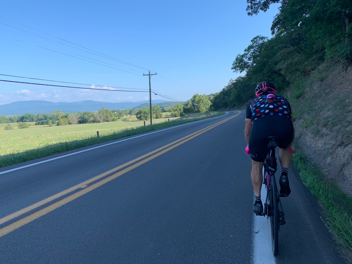
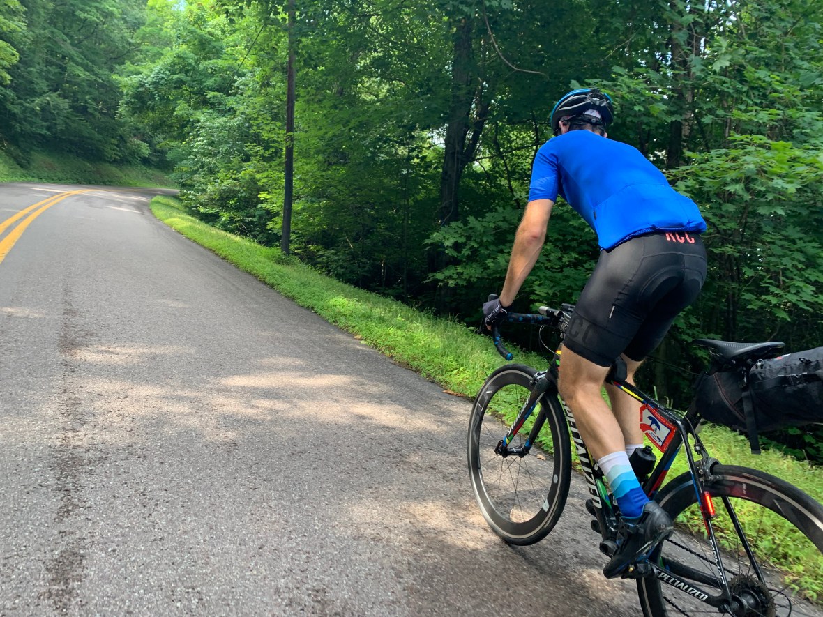
We hadn’t even been riding for 10 miles when we hit the first significant climb, 1,200 feet over 3.4 miles through Wolf Gap. We reached the apex of the climb right before sunrise and coasted into West Virginia. The mountain air temperature was perfect – we both wore short sleeves and bib shorts and as we pedaled through the valley I had but one noble thought: THIS IS THE EASIEST RIDE I HAVE EVER DONE.
me starting to hammer with 360 miles to go because this is a piece of cake
My suspicions were confirmed as we effortlessly cruised up the Mill Gap climb (4 miles, 726 feet) and down into Lost River. We rolled into our second control, the Lost River Grill, at 7:09am. We had covered our first 33 miles in just over 2 hours.
We took our control picture, got ourselves situated, and rolled out 8 minutes later.
SEGMENT 2: Lost River, WV to Moorefield, WV
Like all good bicycling nerds, we had a spreadsheet. It listed all of the controls, key climbs, distance between stops, time allotted for each stop, and a ton of other information. Along with the route loaded on our bike computers, this was the guidebook that would get us through the ride. I am embarrassed to say how much time we put into making it, but let’s just say it was a collaborative effort and was EXTREMELY useful.

yes, you may touch my spreadsheet
Now I am not one to cast aspersions, but the Dove Hollow Road stretch of Big Savage is, as they say, Hillbilly As Fuck. The road is in terrible condition and rolls through an area which seems to be perpetually down on its luck. Cranky dogs stalk you as you bump-bump-bump by their houses. The silver lining is you are so focused on not destroying your rims on razor-edged potholes you barely notice you are doing a four mile climb.
Dove Hollow dropped us out into Lost River State Park which is just a phenomenal natural beauty. You want to ride in a trance, enjoying the verdant lushness of the forest but unfortunately you can’t because you are now on Howard’s Lick (gross) Road, about to climb up the easy (haha) side of South Branch Mountain. 7.2 miles and 1,500 feet seems reasonable, but like most climbs, it bows up here and there. It was on these pitches I decided it would be cool if I dropped something. THREE TIMES I dropped my sunglasses or reading glasses, had to unclip, reclip with enough momentum that I wouldn’t fall over, and continue up the climb. Nothing is more terrifying than being clipped in on the road and at that tipping point where your weak core muscles and balance are about one millimeter away from failing you before you go down, hard.
bottom of howard’s lick – fancy smooth roads are for city slickers!
Brad charged by me on our way up, but despite my penchant for dropping things, I made it to the top a full seven minutes faster than the year before.
Oh yeah, I may have neglected to mention that we had tried this ride just last Fall. In fact, we had to be rescued by my SAINT of a wife after we were stranded in the dark, in an absolute deluge of a storm in Grantsville, MD, a scant 60 miles from the finish. Having to quit with 60 miles to go left such a black hole in me that for months afterwards the best I could do was grunt despairingly whenever the subject came up.
I only mention this as a reminder that I am 1) soft and 2) good at making bad decisions.
Exhibit A: Once you get to the top of South Branch, you get to go down, and in this case it’s a 2,000 foot screaming plunge that lasts for five miles. Last year it had rained and the descent was wet and I looked at Brad and in a weird voice proclaimed “DON’T BE A HERO!”
A minute later I was going too fast around a wet turn and locked up and skidded into a guardrail. Hard. I was hurt, but my bike was fine, so I shrugged it off and eased down the rest of the way. Don’t be a hero!
This time around it was dry, I managed to keep it upright, and we made it down 17 minutes faster than last Fall!
Lesson learned. Maybe.
rolling into Moorefield
SEGMENT 3: Moorefield, WV to Keyser, WV
We hit Moorefield at almost exactly 9am. We were making incredible time and treated ourselves by riding about a mile off course to a luxurious breakfast at the Moorefield Sheetz. We had 20 minutes budgeted but allowed ourselves 30. I ate and drank as much as I could but made a point not to sit down. I am a professional trash panda, after all.
The stretch ahead was going to be bad, probably the worst part of the ride – one signature climb (Morgantown Road) followed by nothing but false flats and annoying rollers. The 40 mile segment was so desolate that the only option for any type of sustenance was a roadside church’s outdoor faucet.
The Morgantown Road climb is legit – a category 2 climb of 1,200 feet over 3.7 miles, and at the top you get to be completely depressed by a mining operation that has lopped off part of the mountaintop. That said, if you squint your eyes you do get the benefit of a gorgeous view.

extremely cropped pic of the top of morgantown road – look straight ahead and everything will be fine!
As with most big climbs, the screaming descent on the other side and the views on the way down make every drop of sweat you grind out of your body worth it. We were so refreshed and completely locked in that, tempting fate, we elected NOT to stop at the emergency church water stop. In an amazing reversal of fortune, our terrible decision here actually paid off, and we realized some additional time savings on our way into Keyser.
Still, the stretch was a grind and the only way to get through it is to put your head down, swallow your feelings, and pedal harder.
Brad is sad because this segment will never. fucking. end.
SEGMENT 4: Keyser, WV to Grantsville, MD
Our plan was to get to our next control, the Jonah E. Kelley Memorial Bridge, at 1:30pm, and after snapping a quick pic, we rolled up to Martin’s Grocery in Keyser at 12:15pm, way ahead of schedule. We covered the previous 41 miles in a (relatively) scorching two hours and 32 minutes and according to THE PLAN, we were supposed to have lunch here and leave by 2:00pm. We made the executive decision to push lunch down the road and just take a quick 20 minute break. While the temps were reasonable (high 70s/low 80s), we were still pretty dehydrated from the century we had just casually knocked out.
I think it was at this stop that I discovered orange Red Bull and now I know how the first person that ever tried crack felt. After chugging it, I immediately disassembled my entire drive train, cleaned it, put it back together, and headed off down the road! (editor’s note: Brad pls verify this part).
The big bad boss of this stretch was the climb up through the town of Westernport, and over Big Savage Mountain. It was the middle of the day and there is very little tree cover going up through town and over the mountain. There’s traffic, and the climb is steeeep (that is four e steep).
If you are a fucking badass (hi!) and elect to go off course and do the Westernport Wall, that will take you straight up Rock Street, which becomes Westernport Road as you leave the town and go over the mountain. Please note that the Westernport Wall is the purposely unmaintained and shitty world famous feature made famous by Savage Man Triathlon. It is all cobblestones(?) and broken shit and grass and dirt and I found myself standing and pedaling in my 36×28 (lowest) gear and drifting, drifting to the left with every pedal stroke.
As I neared the end I realized some safety nerd installed a fence AT the top to keep people from going down the wall (because you will die or kill someone if you try it). You have to bunny hop a corner curb at negative 2 miles an hour to continue up the mountain. For the record I managed to not bunny hop, but instead semi-unclip and rack the fuck out of myself while lifting my bike over the curb at slow speed. Fortunately there is a cross street at the top and I was able to re-clip and hammer back up to 5 mph for the remainder of the climb. THANK GOD.
If you do this ride (don’t) you are really doing a disservice to yourself if you detour around the wall. Fortunately, you can always hold your breath for seven minutes and punch yourself in the crotch if you want to replicate the experience.

Rock Street and the shitty 30%, un-maintained Westernport Wall (the trees obscure both the top and the dead bodies)
I wish I could take a pic of the initial incline of Big Savage Mountain, but the prospect of doing anything one handed on that grade with my weakass core strength is daunting at best. Suffice it to say I felt like a cartoon character driving his car up the side of a skyscraper (with the moon roof open and the sun beating down). The whole climb is about 1,900 feet over almost eight miles, and it is heavily front loaded.
Once you get through the meat of the climb, what a payoff. Another one of those times where you try so hard to commit everything to memory because you don’t ever want to forget. Of course I was trying so hard to remember everything that I forget to take a picture. I’m convinced that we are wired to largely forget the beauty and difficulty of challenges so that we can be motivated to keep trying them over and over again.
The good feelings quickly dissipated as we had to deal with about 10 miles of annoying rollers before we arrived at our lunch stop in Grantsville. Raise your hand if you hate rollers. Yeah, yeah. Stop lying. Anyway, it was during this time that black clouds were starting to form to our north and it was becoming very apparent that our weather luck was about to run out.
SEGMENT 5: Grantsville, MD to Hancock, MD
We rolled into our next control, the Grantsville Pilot, just before 3pm. We were now 90 minutes ahead of schedule. Brad celebrated by ordering Arby’s. While he was ordering I stood in line and as I breathed in the aromas of the Arby’s my body made it known to me in no uncertain terms that eating fast food would be a really bad idea. The cashier asked what I wanted and I just said “umm I lost my wallet” (wtf?). I turned around and headed back into the convenience store connected to the Arby’s and grabbed as much trash as I thought I could keep down.

Hi I am eating my lunch at 315pm at an Arby’s attached to a Pilot Convenience store. How is your day going?
So while lunch was great and we had a huge time cushion, shit was going down outside. Shit being the weather, which had not been forecast to be bad, but I guess when you are riding 190 miles in a day it’s hard to predict with 100% accuracy what is going to happen. With visions of last year’s disaster fresh in our minds (seriously it rained INCHES for HOURS, all through the cold night) we hustled outside. Some parking lot idiot mentioned that we were about to get wet and I immediately told him to go fuck himself (IN MY MIND I DID THAT).
As the clouds gathered we took off, just hoping to somehow beat the storm to Frostburg which was a little over 10 miles away.
We did not beat the storm to Frostburg. Within about 10 minutes the heavens opened up and we were completely exposed heading east on Route 40 (Old National Pike). The wind and rain and lightning forced us to seek shelter at an elementary school that was creatively named Route 40 Elementary School. We waited for the storm to end. I was disconsolate, knowing that we were stuck here for a while and that we would probably be slowed on a wet version of one of the best descents on the ride – the 10 mile 2,000 foot plunge down the Eastern Continental Divide.
How long would this last? My best guess was 30 minutes but storm clouds surrounded us, meaning it could be hours before the deluge let up. Our ride was fucked, we were fucked, and there was now a serious chance that we were not going to finish this thing. Route 40 Elementary School, really? What a dumbass name! IDIOTS! GAAAWWWD.
Eight minutes later the rain almost completely stopped and we headed back out. I reminded myself that I could probably stand to be less dramatic about things.

Time to fly!
We hit Cumberland at a quarter to five and despite our rain delay, were still 90 minutes ahead of schedule. God love Cumberland, but it is sketchy as fuck. It’s the one place where I feel like our bikes are constantly in danger of being stolen by tweakers. We made a brief stop at the Sheetz to load up on drinks and we took turns watching the bikes while the other person went in. Of course when folks would ask us how far we were riding or where we started that morning they looked at us like WE were tweakers which I guess is probably true in some respect.
We were still 40 miles from our turnaround and we had arguably the hardest climbing ahead of us. The four Race Across America (RAAM) climbs totaled about 4,640 feet and I can’t describe them any better than Damon did back in 2015:
The stretch from Cumberland to Hancock is a stage in Race Across America, and it’s the stage with the most climbing per mile of any stage in the country. The elevation profile tells the story: it’s a series of 1,000-foot-high saw teeth that lasts pretty much until the moment the ride ends. It got to the point that I lost track of whether the climbing was done; each time, the answer turned out to be, “Well, yeah, except for this 3-mile climb.”
The first three climbs were as hard as advertised, but we did a good job of grinding them out. As we started the 4th climb I felt my body starting to fade, hard. Brad charged up Sideling Hill and I could not keep up. I chugged water and pulled a Stroopwaffle out of my back pocket. I devoured it, thinking “wow these are way thicker than I remember”. I immediately felt better and also realized I had just speed-eaten two Stroopwaffles at once (a feat to be proud of, for sure and probably a record that no one else has attempted).
We rocketed down the other side of Sideling and arrived at the Welcome to Hancock sign at 7:49pm, well ahead of our 10:05pm target. Even with 31 minutes of stopping time we still completed that 60 mile leg with over 6,000 feet of climbing in 4:21. We briefly toyed with turning around and reversing the RAAM climbs and getting a hotel after that, but I didn’t want to push our luck. So at the risk of living monotonously, we hit Sheetz for dinner and rolled to our hotel.

Thank you, Hancock!
Brad managed to get into a fight with the hotel desk clerk, which was awesome, but he did save us from having to store our bikes in a locked shed(?), so score one for being confrontational (which is uh not my strong suit). We were in our room by 815pm and to celebrate I immediately drank an entire half gallon of chocolate milk because I thought it would be funny if I did everything I could to sabotage my sleep and subsequent return trip the next day.
Like most weeknights I fought the urge to projectile vomit from over-consuming and was asleep by 10pm.
Blackout sleep after 190 miles and 21,000 feet of climbing is incredible. My dreams are dumb and pedantic (like the dreamer!) so I am just as happy not to have them. Apparently there were some dudes being loud af outside until all hours, but I was blissfully unaware. Hashtag motor lodge life!
SEGMENT 6: Hancock, MD to Grantsville, MD
It’s difficult to describe the feeling of riding 190 miles, climbing 21,000 feet, sleeping for four and a half hours, and then getting up at 2:30am and rolling out into the darkness at 3:30am. Looking back I honestly am not sure how I did it. I can barely make it out of bed on Tuesdays for local 25 mile hill rides. Plus we were already behind schedule. Our stop took an absurd 7.5 hours of which only 4.5 hours was sleep. We were scheduled to leave at 3am and despite skipping Sheetz didn’t start rolling down the road for good until 3:37am. There was no way we were going to be in Cumberland at 6am. Everything was in jeopardy – the fastest time, sub 40 hours, and just a few hours later – finishing would be in doubt.
The headwind was already draining my energy and as we rolled down what should have been a fast descent I could barely turn the pedals. We had knocked out three of the climbs and I guess that had completely done me in. I could not stop yawning. Everything was in slow-motion.
As usual, I was dozing off, dreaming for a second or two before waking up and regaining control of my handlebars. I seriously considered whether I could just lay down on the side of the road for 30 minutes, just to, you know, catch my breath. I think I was delirious.
Like all good SRRPs, Brad noticed something was wrong and pulled over and waited for me to catch up. Maybe that little bit of dreaming was all I needed because suddenly I felt fine, disaster averted, and we rolled up and out of Cumberland at 6:45am (just 45 minutes behind schedule).

sunrises, 100% good
We decided to push breakfast off to the Winchester Sheetz which was a few miles down the road from Cumberland. It was still early and we had already knocked out five tough climbs (getting out of Cumberland and then the four reverse RAAM climbs).
The next climb was a beast – the 8.6 mile, 2,000ft ride up to the Eastern Continental Divide. The thing about this one is that while the road has plenty of shoulder, the traffic is heavier than most of the rest of the ride, it’s loud, and you are completely exposed. You feel the sun and the wind. Plus your reward for making it to the top is the Hellpit combination Pilot-Arby’s, so the motivation is not all there. Still we managed to keep it together and arrived just before 9am – just under 5.5 hours to travel 60 miles and climb 8,100 feet!

IS THIS FOOD MMMM IT TASTES LIKE FOOD!
SEGMENT 7: Grantsville, MD to Keyser WV
Pressed for time, we were in and out in about 10 minutes. Now we were in good shape. The segment to Keyser featured just one big climb (up Westernport Road for 4 miles and 1,200 feet) over 26 miles. The route is impossibly green and the lead in to the climb is just a wonderfully long gentle descent. Long descents, whether biking or skiing or running or whatever, might be the best drug ever invented.
Most of the time our climbs together go something like this: I have my head down and sweat is pouring out of my face. I am not talking. Brad is effortlessly spinning and running navigation/play-by-play as we pedal along.
“just a half mile of this…”
“okay one more mile and then the turn at the top and then almost done…”
“a little more after this false flat”
I have often said I don’t want to know anything about a climb, don’t tell me, leave me alone. But over time I have come to love this feature of our rides together. Me, dying, him, cheerfully navigating us up another climb.
Big Savage Westernport Road – even the easy climbs are hard.
The sensation of flying down the business side of Big Savage Mountain into the town of Westernport is something I hope everyone who rides bikes gets to feel one day. It is thrilling and steep and terrifying. Westernport, MD has been dropped on this mountainside and seems completely isolated from the rest of the world. Of course dumbass me often fantasizes about living in a place this steep. If I could walk up and down these streets every day I would live forever!
Either we went REALLY fast or we hit some wormhole or something, because when we arrived in Keyser, WV at 10:55am we had shaved 20 minutes off of our time.
SEGMENT 8: Keyser, WV to Moorefield, WV
Now I’m not going to lie, Keyser also feels sketch. I’m sure it’s a perfectly nice town, but I always get a weird vibe here. I think part of it is that the Subway slash Gas Station right in the middle of town has bathrooms inside which don’t lock or have working lights. Not sure that’s up to code, but hey, alright. I’m also going to go out on a limb and say that all Subways are not created equal and I should have remembered that when I decided this was going to be my lunch. How much honey mustard do you need to put on a sub? It didn’t matter as I was at that part of the ride where something annoying happened no matter what I did. Motor function and decision-making was quickly diminishing. Either I was dripping mustard on my bike or kicking a door or dropping change or using the bathroom in an unlit, unlocked room.
It was probably the bad ju-ju but we took waaaaay too long to get out of Keyser (does anyone get out of Keyser?) and left town about 30 minutes behind schedule.
We were back on the shitty rollers that never end portion of the ride, 40 miles of valley that had some beautiful views but not a whole lot else. This time we decided it would be wise to stop at the Assemblies of God church and load up on water from the outdoor faucet and I may or may not have take advantage of being in the middle of nowhere and whizzed in the parking lot (I didn’t, if my kids ever read this).

I guess I can tolerate this for the next 40 miles
The stretch is punctuated at the end by the climb up Morgantown Road to the strip mine, but by this time we kind of laugh at climbs that only average 250 feet per mile. So laugh and cough and dry heave we did, all the way to the very top.
SEGMENT 9: Moorefield, WV to Lost River, WV
Being the logistical geniuses that we were, we decided to save time and forego the Moorefield Sheetz and instead stopped at the Food Lion on the way into town. When Food Lion is your move then you know you are basically playing with house money.
We were now just 15 minutes behind schedule with just one significant obstacle facing us: South Branch Mountain. Really, this climb, which has a sub-segment called “A Special Kind of Hell”, is one of the hardest road climbs I’ve probably ever done. Once again, I will let Damon describe its majesty:
The 28-mile segment to Lost River was a one-trick pony. That trick was a 2,000-foot climb up South Branch Mountain, which I’d never heard of. Bill Beck, the organizer, had rated it the toughest climb on the route, but I was feeling better, and I’d climbed some tough stuff in my day. It was only one climb, so HTFU, right?
As it turned out… no. Not even a little bit. This climb utterly crushed me. Neither one of us made it up without stopping, but for me, that wasn’t the half of it. I wound up walking my bike almost a mile up this thing, something I hadn’t done in the history of my cycling career. (So much for the squeaky clean new bike shoes.) Not that walking it up was straightforward, frankly. I still had to stop periodically to double myself over against the railing while the world came back into focus.
Here’s the bottom line: If you don’t have a triple or the gearing equivalent, this climb will almost certainly break you. It is easily as difficult as the final climb at Mountains of Misery, and your legs will be more tired when you get there. If you’re riding this route the other way, such that you hit this on Day 2, may God have mercy on your soul.
I’ve rarely been in as despondent a frame of mind as I was on South Branch Mountain — cracked, cramping, exhausted, dehydrated, with 60 miles to ride before sleep, and then facing the prospect of doing it all again the next day. If I’d had a “pick me up” button, I’d have pressed it, no question. In fact, I told Max I had no idea how I could possibly ride the next day — I’d already had one very bad outcome on a ride this year, and I couldn’t face another.
We did finally make it to the top. I don’t want to talk about it. This climb shouldn’t exist, least of all on this ride.
I tear up a little whenever I read that description (I also pee myself). It is hands down one of my favorite passages of anything I have ever read, in my life. HOLY SHIT. That is a climb. Sure there are harder climbs out there, much harder climbs. But the location of this climb, particularly if you get the tough side on day 2 and 320 miles down already. Well…it’s brutal.
That’s not to say that we didn’t stomp the shit out of it. We did. One day I would like to come back and see how fast I can make it up with the benefit of fresh legs. I don’t even remember the descent, just that I was so sublimely jubilant I probably wouldn’t have cared if I had ridden off the side of the mountain to my doom.
Then we hit Dove Hollow Road and suddenly all of the good feeling was gone.
Every saddle sore, muscle tweak, and back ache I had intensified as we bounced down Dove Hollow and its non stop potholes and imperfections. Every 20 feet I was by getting up out of the saddle to avoid the feeling of the road crushing my body. I tried to get into a tuck to save my shoulders but my hands go numb. BAM! Another pothole and I think I might have actually squealed. Unlike on the way out, Dove Hollow is now a descent so every fault in the road gets hit at a much faster rate. All of the accumulated fatigue of the last 35 hours manifests itself. Did I just hear a dog? Pedal faster. If you die out here your wife will have “I told you so” engraved on your headstone and you will be mocked for a hundred years.
BAM. POTHOLE.
The last bit of hydration leaks out of my right tear duct.
We arrive at the The Lost River Grill at 5:15pm and just like that, we are back on schedule.
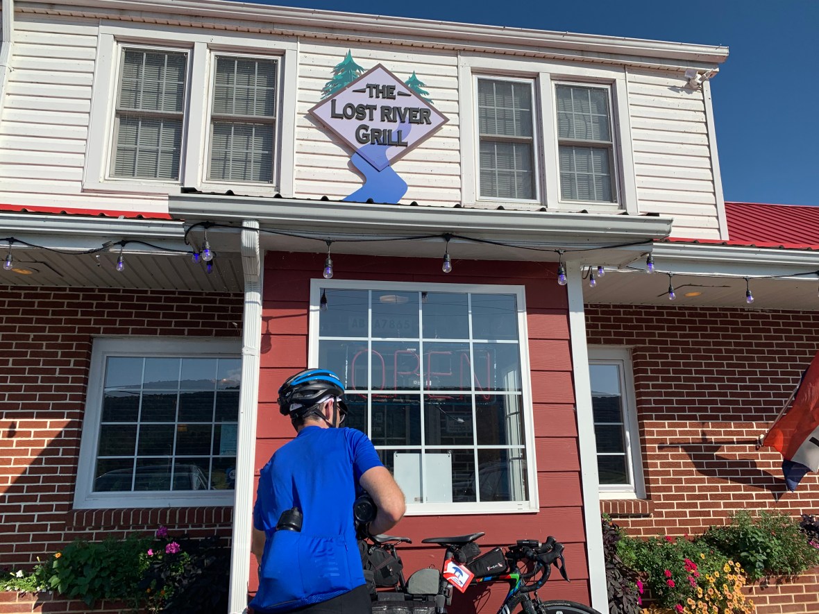
famous for a good reason – don’t be like us, take time to eat here
FINAL SEGMENT: Lost River, WV to Woodstock, VA
We had two medium climbs over the final 32 miles to get to the finish and two hours and forty minutes to get there. Unless something extremely bad happened, not only were we going to finish IN daylight, we were going to break 40 hours! Fortunately the climbs were over quickly and for the first time in two days, we worked together to knock out some flat miles. Brad tucked in behind me on what felt like a major victory lap as we hammered the final 4 miles into town at 25 mph.
We tore into the 7-11 parking lot and Brad picked that exact moment to wreck his bike while hopping the curb onto the sidewalk infront of the store. I couldn’t be bothered to render aid. I stopped my Garmin, ran in the store, and bought something so I could get a valid receipt (vape juice? banana? I can’t remember).
Out total elapsed time was 38 hours and 22 minutes. We had the incredibly good fortune of zero mechanicals, zero crashes (well almost zero), and 99% perfect weather. We just hung out in front of the 7-11 for a long time, feeling the glow and absorbing what we had accomplished. So long, in fact, that when I went back inside to buy something else, the snotnose little fucker behind the counter commented that “you two sure have been here a long time”.
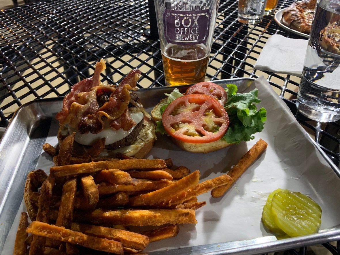
We got our revenge by immediately leaving, changing in the hotel parking lot, and driving to Box Office Brewery for cheeseburgers and beer.
Real talk time.
I would do this ride again. In a heartbeat. It is beautiful and brutal but I really do love it. I feel like we could probably be a little more efficient, too: in our stops, in our nutrition. I probably don’t need to drink 5 orange Red Bulls. Since the ride I have occasionally looked up property in the Lost River area. I never thought I would be a West Virginia property owner, but I could see it now. Having a home base to launch big stupid rides over South Branch and Savage Mountains? That would be incredible.
I’m also proud of completing yet another stupid ride with Brad, particularly after we had Everested just a few weeks earlier. More importantly, we came back after utterly failing last fall. I know that didn’t sit well with him, and it definitely didn’t sit well with me.
Here’s to friends who won’t leave “well enough” alone.
totally worth it

Did someone say timeshare?
LikeLiked by 1 person
Pretty sure we are common law in 32 states
LikeLike
U R Dum
LikeLiked by 1 person
❤️❤️❤️
LikeLike
I believe the preferred nomenclature is Stupid.
LikeLike
Awesome story. Sounds brutal. Ive done Savageman half three times and Garrett County Gran Fondo 125 twice, and can only imagine how mich harder this must have been over so much more terrain. John McManus
LikeLiked by 1 person
Thank you! Garrett County GF is like a gateway drug to this. I love that ride.
LikeLike